
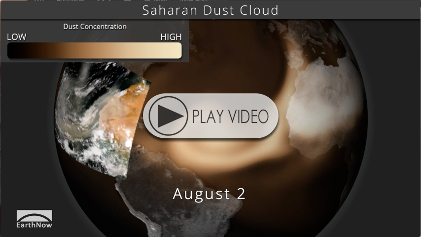
Saharan Dust Cloud
SOS Playlists
 SOS Playlist
Overview
Over the past several days, a large dust cloud has moved from Africa’s Sahara Desert over the Atlantic Ocean. NOAA’s satellites detected the plume of dust several days ago. moving off the coast of Africa. Dust clouds like this are relatively common and are part of the Saharan Air Layer, but this particular plume of dust is highly concentrated. The high concentration will not only lower visibilities for any areas along its path, but has the potential to suppress hurricane development. NOAA models forecast the the dust plume to travel across the Atlantic over the next several days.
Dust Cloud VIIRS PIP
About the Dataset
Dataset Name: 20130802 EarthNow: Sahara Dust Cloud
- The dataset shows the global concentration of aerosols, like dust. The data is derived from an enhanced version of the NOAA NGAC aerosol model and shows the progression of dust across the Atlantic.
- The colorbar conveys the range of dust concentration from Low to High
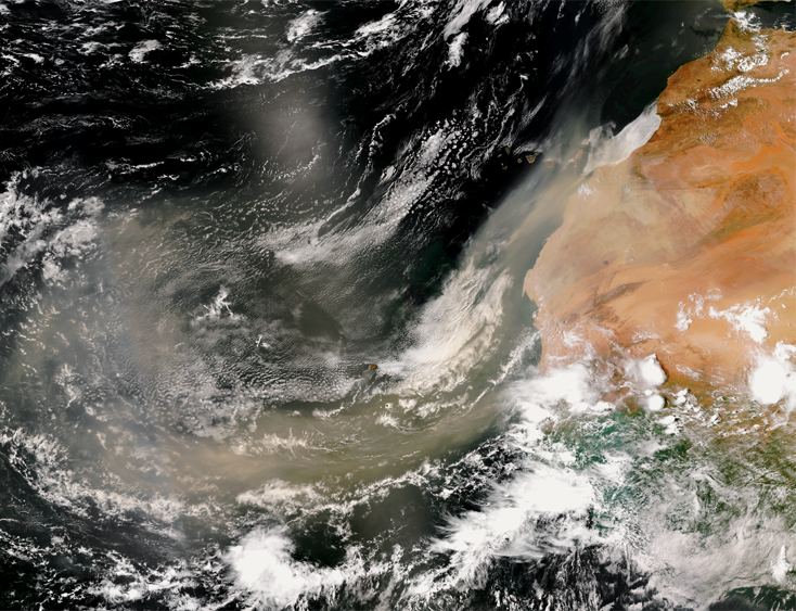
- A Picture in Picture (PIP) shows the dust cloud on July 31st as seen by the Suomi NPP satellite’s VIIRS instrument.
Where do I find the datasets?
-
First, check your SOS system to make sure it’s not already in the EarthNow category.
-
If not, you can download the datasets and playlist files from this FTP Site.
-
Then download and use playlist files at the top of the page (or create your own) and make sure they are in /home/sos/sosrc or /home/sosdemo/sosrc.
-
More detailed information here
Helpful Resources for More Information
-
http://go.wisc.edu/n8l9ly NOAA Environmental Visualization Lab


