Overview
For the past 15 years, satellites that measure the color of the ocean have given us a view of sea surface phytoplankton which form the base of the food web and half of all the oxygen we breathe. These satellite data are being used to understand fish distributions and why some fisheries suddenly collapse. Read on for more information about the relationships between climate cycles like El Niño and their effects on phytoplankton and fish distributions.
SOS Catalog link http://sos.noaa.gov/Datasets/dataset.php?id=574
About the Dataset
Dataset Name: 20130315 EarthNow: Chlorophyll – El Nino
Audio Dataset Name: 20130315 EarthNow: AUDIO Chlorophyll – El Nino
- Polar-orbiting satellites are able to detect subtle differences in ocean color, allowing scientists to see where there are higher concentrations of phytoplankton, a proxy for the concentration of chlorophyll in the ocean.
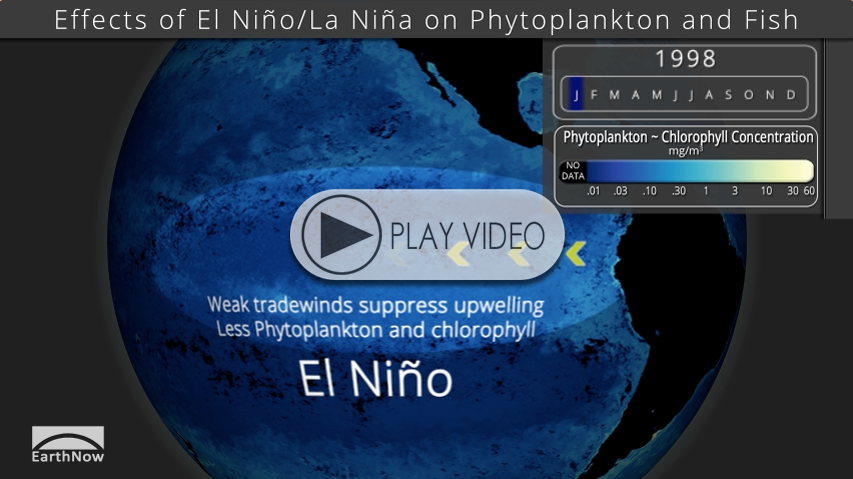
- In this dataset, the dark blues indicate area with little to no amount of phytoplankton, whereas the yellow-green colors indicate areas with very high concentrations.
- The animation starts with animating the full dataset (September 1997 through January 2013).
- Then, examples of how winds impact the phytoplankton concentrations, as well as El Niño and La Niña examples are shown. These examples are followed by the impact on fisheries and other aquatic wildlife. Finally, two more full loops of the dataset are shown, the first highlighting El Niño and La Niña events.
The Impact
Phytoplankton abundance is controlled by the availability of sunlight and nutrients. Winds over the ocean drive currents away from the coast and equator, creating a void at the surface that’s filled by nutrient-rich water from the deep ocean upwelling to the sunlit surface.
Combining satellite data with samples collected from the ocean enables scientists to better understand where these microscopic plants live and support different ecosystems and how physical and chemical changes affect them.
Seasonal changes are most obvious. Slower changes are also apparent, one of the largest being El Nino in the tropical Pacific, with an approximately 5 year cycle. El Nino causes reduced upwelling, with warmer water and less phytoplankton; its opposite phase is called La Nina with more phytoplankton than normal.
Since phytoplankton form the base of the food web in the ocean, they impact animals higher up the chain. A major consequence of El Nino is the loss of commercially important species from their usual location: anchovies around South America, squid off of California, salmon around the Pacific, and others.
Not only fish are impacted, but animals that depend upon them such as sea lions, seals and sea birds experience famine.
Understanding El Nino and other natural and man-made causes for fisheries collapse will guide decisions about how to help them recover.
Where do I find the datasets?
-
First, check your SOS system to make sure it’s not already in the EarthNow category.
-
If not, visit the SOS Catalog http://sos.noaa.gov/Datasets/dataset.php?id=574
-
More detailed information here
-
Magic Planet version


