2012 Arctic Sea Ice Minimum • iPad Video
SOS Playlists
 SOS Playlist
 SOS AutoRun Playlist with Audio
Overview
Last month, we showed how the Arctic sea ice reached a record low on August 26th. However, the minimum each year actually occurs in September and so we wanted to provide you with an update on the official 2012 minimum. The National Snow and Ice Data Center’s preliminary announcement suggests September 16, 2012 as Arctic minimum sea ice date.
About the Dataset
Dataset Name: 20121003 EarthNow: 2012 Arctic Sea Ice Minimum
 Still Map Image
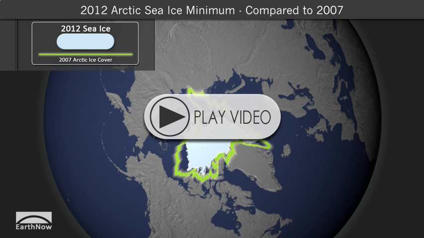
- This SOS visualization shows the September 16, 2012 sea ice extent in the light blue/gray color.
- The green line is the 2007 minimum ice extent, the previous record minimum for the Arctic.
- This visualization is derived from the existing real-time snow and ice dataset.
New Record
On September 16, the Arctic sea ice extent was 3.41 million square kilometers (1.32 million square miles), the lowest seasonal minimum extent in the satellite record (since 1979). The 2012 minimum is 760,000 square kilometers (293,000 square miles) below the previous record, set on September 18, 2007. Further, the 2012 extent is 49% below the 1979-2000 average minimum sea ice extent. From this point forward, the Arctic sea ice extent will grow as the northern hemisphere enters fall and winter.
Perspective
- The six lowest minimum Arctic sea ice extents in the satellite record have all occurred in the last six years (2007 – 2012).
- 2012’s summer temperatures were warmer than average, but still cooler than 2007.
- Strong storm in the central Arctic may have helped to speed up the ice lost, in tandem with the Arctic seasonal ice (1 year old or less) becoming more prominent. Thinner ice is able to melt more quickly.
- We’ll discuss the thinning ice situation in a later post.
Where do I find the dataset?
-
First, check your SOS system to make sure it’s not already in the EarthNow category.
-
If not, you can download the dataset and playlist files from this FTP Site.
-
Then download and use playlist files at the top of the page (or create your own) and make sure they are in /home/sos/sosrc or /home/sosdemo/sosrc.
Helpful Resources for More Information
-
http://nsidc.org/ National Snow and Ice Data Center
-
http://arctic.atmos.uiuc.edu/cryosphere/arctic.sea.ice.interactive.html Interactive Sea Ice Graph


