SOS Playlists
 SOS Playlist
Overview
On November 7, 2013 Typhoon Haiyan made landfall in the Philippines province of Samar and later in the populated city of Tacloban. The purpose of this EarthNow post is not to provide lots of information about Typhoon Haiyan. Much of that information can be found all over the internet. We are, however, providing you with some PIPs you may wish to use in conjunction with your real-time infrared dataset, or with the provided Haiyan data. Feel free to pick and choose which PIPs you use and how long they are displayed on your SOS. You will also find a sample dataset in the EarthNow category.
About the Dataset
Dataset Name: 20131118 EarthNow: Typhoon Haiyan with PIPs
- The dataset itself is archived IR imagery from Typhoon Haiyan.
- While showing the IR, the dataset will then cycle through 3 PIPs.
- More information about the 3 PIPs can be found below.
- Credit for the archived imagery goes to Beth Russell at NOAA ESRL.
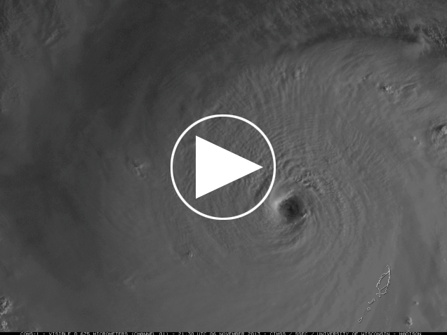
PIP 1: Haiyan Animation
- This high-resolution image of Typhoon Haiyan derived from COMS-1, a South Korean geostationary satellite.
- The imagery is “Visible” not infrared or water vapor imagery.
- Credit for the animation goes to Scott Bachmeier of CIMSS. Check out the CIMSS Satellite Blog for more information!
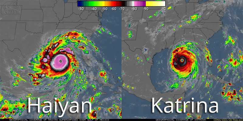
 PIP 2: Haiyan/Katrina Comparison
- In this image, Typhoon Haiyan has been artificially superimposed over the same location as Hurricane Katrina in 2005.
- It should be noted, however, that the size of the storm and clouds does not always translate into intensity.
- The color difference between the two storms indicates cloud-top temperature, Haiyan’s being colder than Katrina’s.
- According to CIMSS’ Scott Bachmeier, this is “due to its location in the tropics (near 10 N latitude) where the tropopause was much higher and much colder.”
- Credit for this image goes to Rick Kohrs at SSEC.
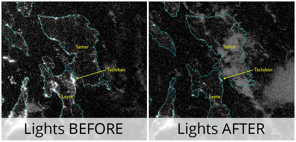
 PIP 3: Loss of Power
- These two images are from the Suomi NPP VIIRS instrument, the newest U.S. polar-orbiting satellite. The new day-night band with this instrument allows us to better see both clouds, land, and lights!
- The first image is from October 31, 2013 before the storm. The second image is from November 9, 2013 after the storm.
- Note the difference in lights, especially in Tacloban.
- The credit from these images goes to William Straka of CIMSS and SSEC.
Where do I find the datasets?
-
First, check your SOS system to make sure it’s not already in the EarthNow category.
-
If not, you can download the datasets and playlist files from this FTP Site.
-
Then download and use playlist files at the top of the page (or create your own) and make sure they are in /home/sos/sosrc or /home/sosdemo/sosrc.
-
More detailed information here


